![]()
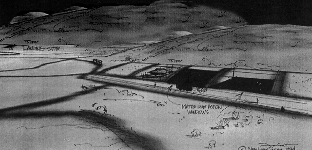
Landing Site.
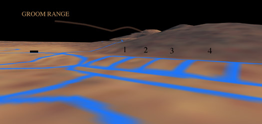
Groom Lake (Area 51), lies on the other side of this mountain range illustrated below.
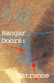
These illustrations were drawn on top of actual spy satellite photos of the Papoose dry lakebed in central Nevada. The coordinates of the hangar doors are N 37° 01' 40", W 115° 46' 35".
United States Geological Survey (USGS) altitude data, combined with a type of "stereo photography" which the satellite employs when exposing the negative we are able to create a three dimensional model of the area Lazar described as the hangar doors.
Lazar simply provided the designers with the coordinates and explanined the path traveled in the bus that drove him from Groom lake to the S4 facility. With that, these recreations were created of typical Wednesday night flight preparations.
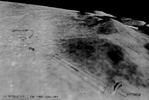 |
The bus with the blacked out windows drove south in the early
evening. The sun would usually be setting to Lazar's right side as he rode the 15 mile
shuttle to S4. Once approaching S4, the bus would drive the length of the nine hangar doors and make a sharp left turn to park. The scientists were let out of the bus and directed to the entrance. This was simply a steel door in the side of the mountain. Refer to the Corridor Entrance. |
Copyright © 1997-1998 JFI INC. NO IMAGES, TEXTS, OR MOVIES MAY BE USED WITHOUT WRITTEN PERMISSION FROM THE PUBLISHER. JFI INC.; ROBERT SCOTT LAZAR, NON-LINEAR BIOGRAPHY. "ROBERT SCOTT LAZAR AND THE PHYSICS OF ELEMENT 115" By Jon Farhat. |